Posts by G8HJT

    Yes, success... My Sat Rx was very easy to set-up.... It has a "Blind Scan" facility and so scans all the standard EPG channels and soon builds up a "TP Table" and a channel list for that satellite !!


    Just a quick nudge to the right on the dish and "Hey Presto!" there it was.... RESULT !!


    Regards


    David

    Thanks for all the replies...

    The Sat Rx is fine and is programmable for many different satellites...

    I have had no problem lining up on Sky @ 28.2

    Being able to decode the Es'hail EPG data was just a bonus for me, to prove I had learned to set up the Sat Rx

    Thank you for the suggestion to use Badr 4 BBC Arabic (on TP 15)

    Looking at the TP Footprint @ http://www.lyngsat-maps.com/footprints/Badr-4-BSS.html I can see THE UK IS COVERED !!


    AND THAT IS THE FLAW! Doooh!!

    The Es'hail TP footprints @ http://www.lyngsat-maps.com/footprints/Eshail-2-MENA.html does not cover the UK, not even France....

    So I was attempting "mission impossible"...


    So now I will go and try a lineup using Badr 4


    Regards


    David G8HJT !!!!

    Ok... My question and the reason for asking it was based upon fatally flawed thinking!


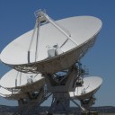
    I am setting up a 1.2metre dish for QO-100.... I have an Green Octogon Quad LNB


    I chose the Quad LNB because I want to feed & run my Air-Spy SDR independently of the amateur radio download/upload side...


    Ok, so I thought a good strategy would be attach my little Edision Progressiv HD Sat Tuner

    (https://www.amazon.co.uk/gp/pr…tle_o08_s00?ie=UTF8&psc=1)

    and to initially line the dish up onto the Sky Satellites @ 28.2E


    That all worked well... So the next step was to pick a FTA DVB-S transponder on the commercial Es'hail satellite and tune the dish up on that as a precursor to accessing the QO-100 Amateur Transponder...


    That failed to work and it took a while for the penny to drop as to WHY? But, Hey! this is all a learning curve... But it was so obvious that I should have realised it in the first place !!


    So what was the flaw?

    Thank you for that :) D

    Sorry.... it is Keyhole Markup Language, similar to XML and used for doing clever stuff in google earth etc. I use it in a simple way to overlay images or tracks on maps. This is rather useful if you have been doing mobile coverage measurements or want to overlay a prediction on top of a map.

    That's ok. I looked it up on Wikipedia.... Could you see your way open to sending me a sample/simple KML file so I can see what the content looks like?


    73's David

    Hi Everyone!


    If I search Wikipedia for "QO-100" it suggests "https://en.wikipedia.org/wiki/Amateur_radio_satellite" or "https://en.wikipedia.org/wiki/AMSAT" and there is actually an "Es'hail 2" page at "https://en.wikipedia.org/wiki/Es%27hail_2"


    Can or would somebody forward "QO-100" to "https://en.wikipedia.org/wiki/Es%27hail_2" on Wikipedia.... (I don't know how to do it :()


    Being just a little bit pedantic, do I understand correctly that Es'hail 2 is the satellite whereas QO-100 is the actual transponder ?? ;)


    73's David

    I have generated a nice map using the Azimuthal map generator at https://ns6t.net/azimuth/azimuth.html

    Center the map at 0°N 26°E and set the radius to 9000km, and if you print the map as a poster on 6-8 A4 sheets you have a nice wall deco :)

    Thanks... It was all going so well until I got this !!

    Internal Server Error

    The server encountered an internal error or misconfiguration and was unable to complete your request.

    Please contact the server administrator at webmaster@localhost to inform them of the time this error occurred, and the actions you performed just before this error.

    More information about this error may be available in the server error log.

    Apache/2.4.38 (Debian) Server at ns6t.net Port 443


    The point is that I wish to zoom the map in !! Like I said in my original post, I don't want the zooming-in to degrade the view !! I want it to add information !


    Your URL achieves that, thankyou!


    I also had a reply from Peter, 2M0SQL, who suggested https://www.n2yo.com/?s=43700 selecting "Draw Footprint" and then "Large Map"


    Thanks to all!


    73's David

    Greetings everybody !! This is my first post... I've been drawing up a list of all the callsign prefixes for all the countries likely to be heard via QO-100.... I started feeling that I wished to have a google map app that displayed the 10 deg & 5 deg rings on the map!! That would make "zooming-in" worthwhile -- with the present coverage map, zooming-in just degrades the display !!


    Is there any chance somebody might feel inclined to create a google map app with those coverage rings displayed...?


    73's David, North Dorset, UK